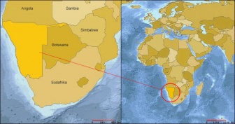
Outapi
Aus Wiki.sah
|
<googlemap lat="-17.506476" lon="14.988699" type="satellite" zoom="14" width="425" controls="large"> -17.50499, 14.99, Outapi, Namibia </googlemap> |
|---|
| Outapi (Satellitenbild) |
| Outapi | |
| auch: | Uutapi oder Ombalantu |

| |
| Stadt | |
| Land: | |
| Region: | Omusati |
| Wahlkreis: | Outapi |
| Geografie | |
| Lage: | 17° 30′ S, 15° 0′ O |
| Zeitzone: | UTC+1 |
| Demografie | |
| Einwohner: | 8.089 (2005) |
| Fläche: | 14.33 km² |
| Bevölkerungsdichte: | 564 Einwohner je km² |
| Sonstiges | |